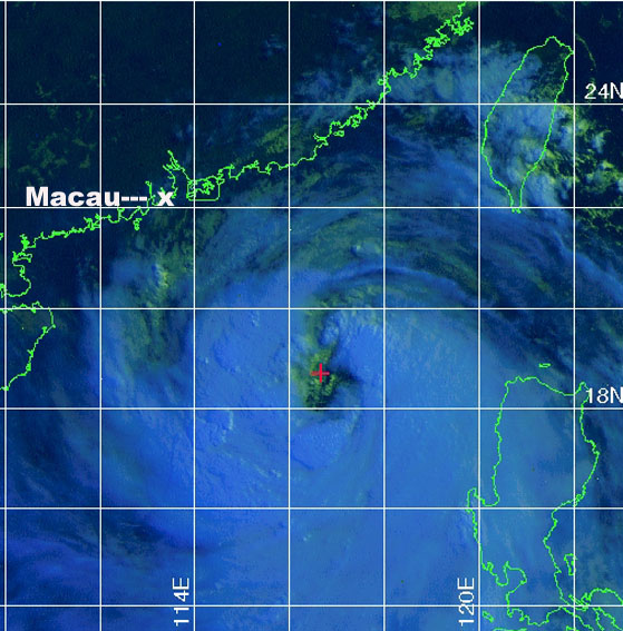
Typhoon Imbudo
approaching China at 2330z on July 22 2003.
Satellite image from The
Joint Typhoon Warning Center
Read the Reuters news report on Typhoon Imbudo
Selected
tracking maps and satellite images from the The
Joint Typhoon Warning Center of Typhoon Imbudo
passing over the Phillipines and approaching China.
Warning
19
Warning 23
Warning 27
Warning 29
|
|
|
|
|
|
|
|
Click on any image above to see the full sized image.
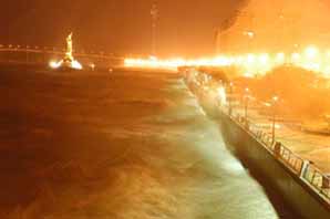
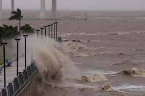
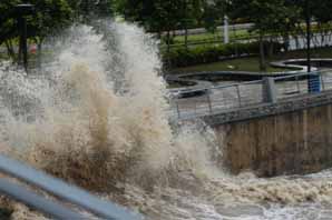
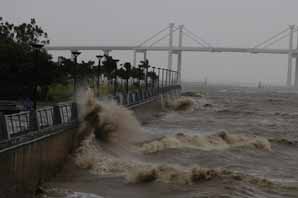
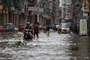
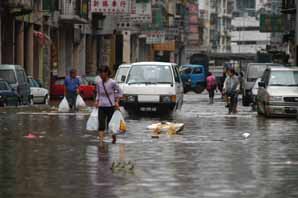
Typhoon Imbudo hit the Phillipines as a supertyphoon then moved on to hit China several days later. Due to the difficulties of access to and transport avaliability in China I decided to get as close to the typhoons landfall as possible by going to the Island of Macau off the coast of Mainland China. The typhoon centre passed within about 100 kms of Macau in the early hours of the morning of the 24th July, causing huge seas, flooding, some trees and power lines were also knocked over. Winds in the downtown probably reached 120-150 kph for an hour or so. Later in the day when ferry service resumed 22 people were injured when a hydrofoil fast ferry hit a rogue wave. (These hydrofoils are the fastest commercial passenger ferrys in the world, they are powered by twin jet enjines and cruise at 45 knots. about 80 kph. !) The one I returned to Hong Kong on an hour after the accident provided an almost glass calm passage at full speed through 3-5 metre seas. Very impressive. Other vessels were having the stuffing pounded out of them.
Geoff Mackley
24 July 2003.
Back
to Geoff's weather links
Back
to site directory